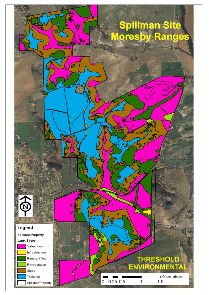
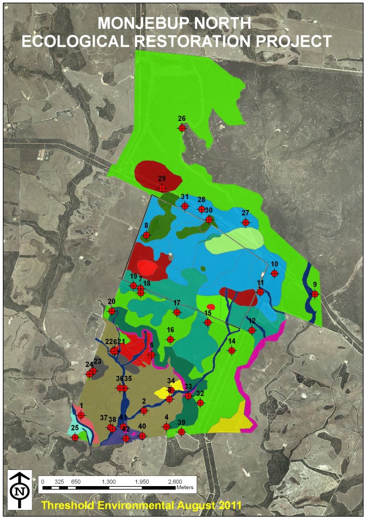
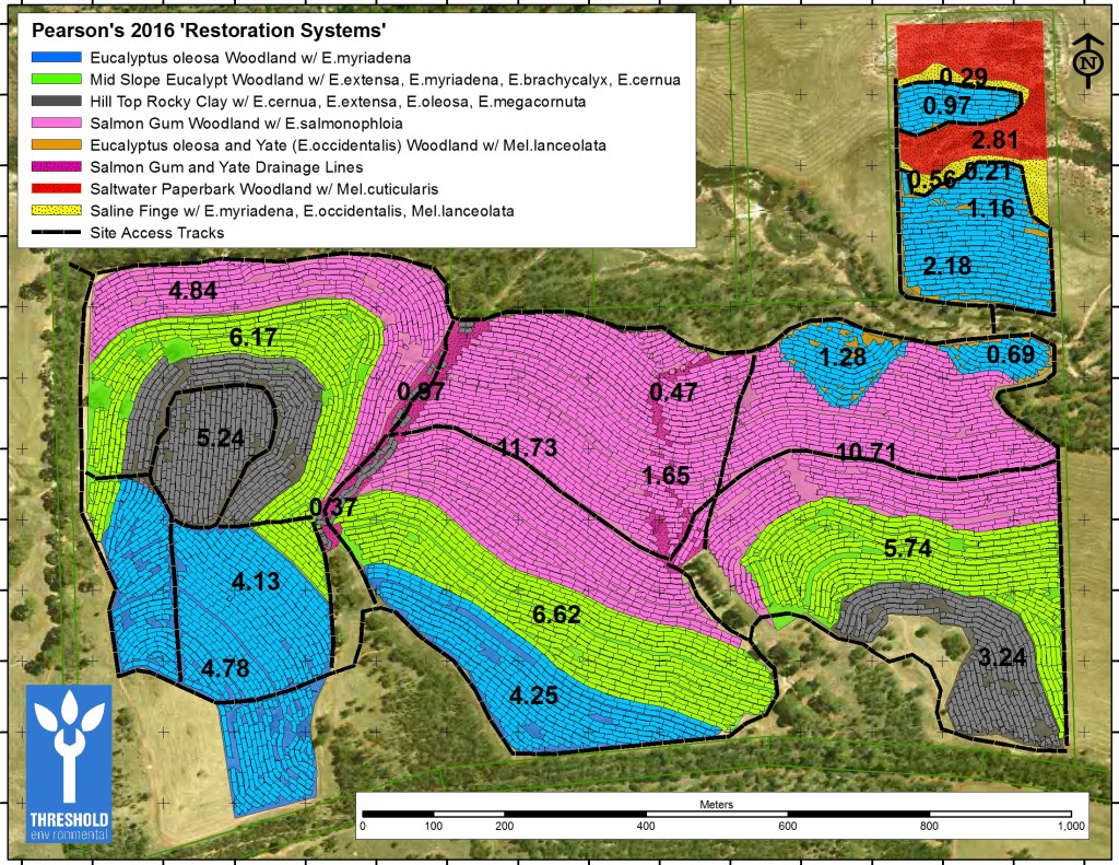
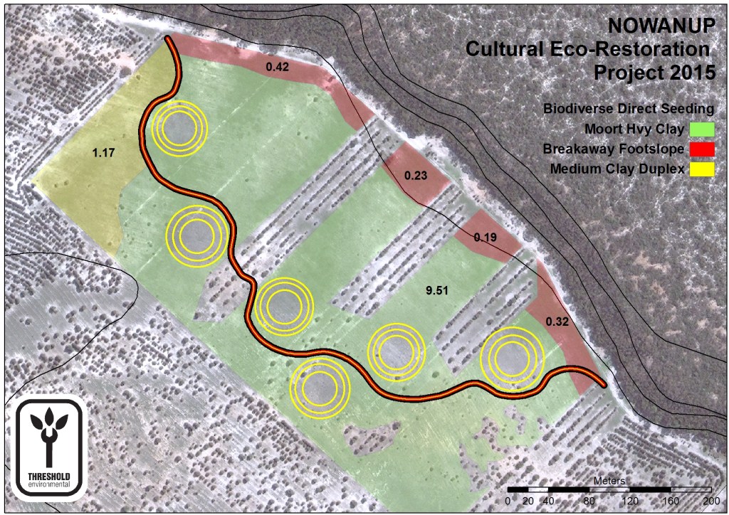
Our planning and design approach starts with a thorough analysis of the biotic and abiotic characteristics of the project site. We collect information on soils, remnant and surrounding vegetation, and combine them with geospatial data to build detailed restoration maps/plans.

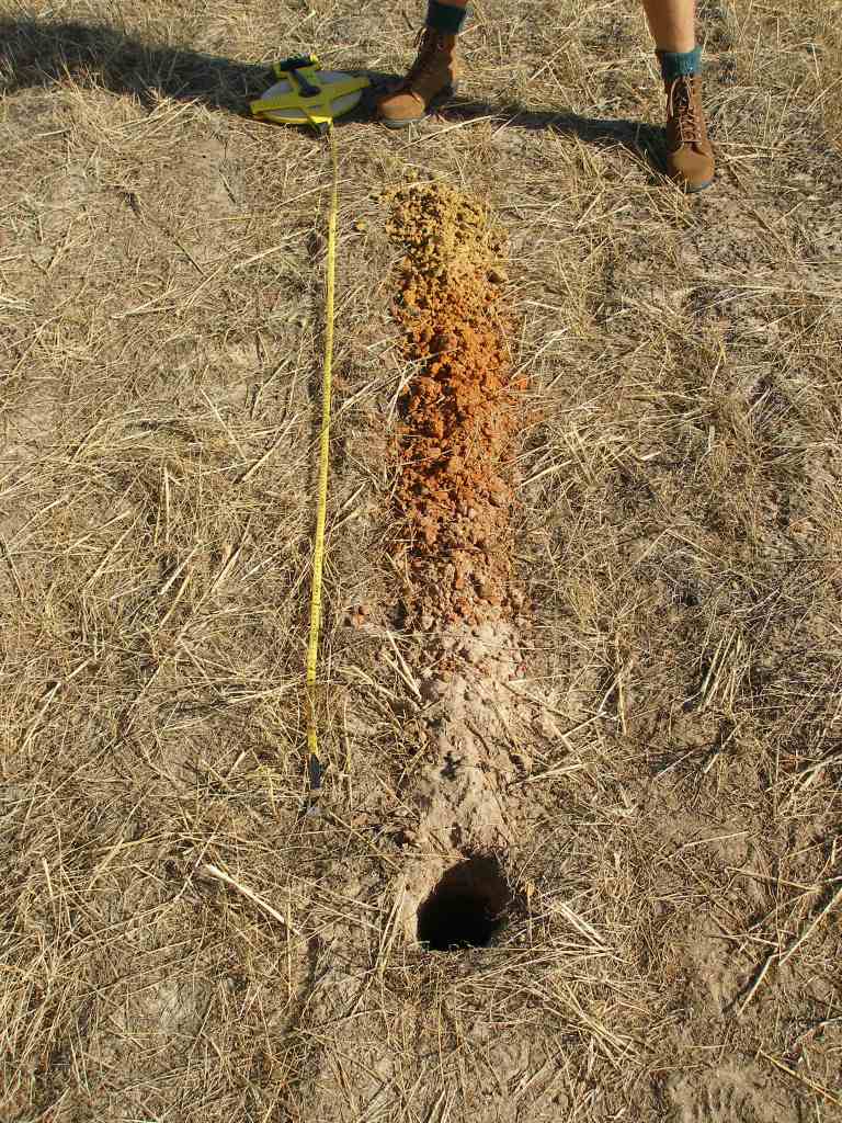
SOIL SAMPLING
To maximise long term outcomes, we evaluate the composition of soils by auguring multiple soil pits across project areas. These pits give us information on profile depths, soil texture, fertility and water holding capacity, which we use to develop a restoration plan. Different soil types relate directly to native plant communities, and the ultimate capacity of each land unit to grow any type of vegetation.


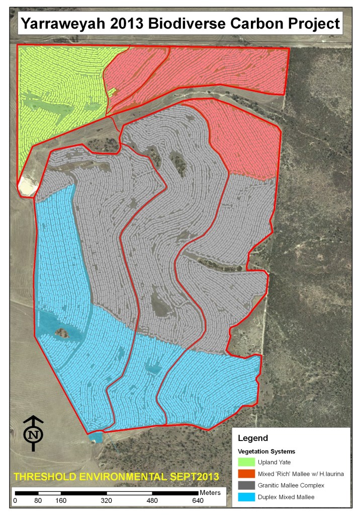
VEGETATION ANALYSIS
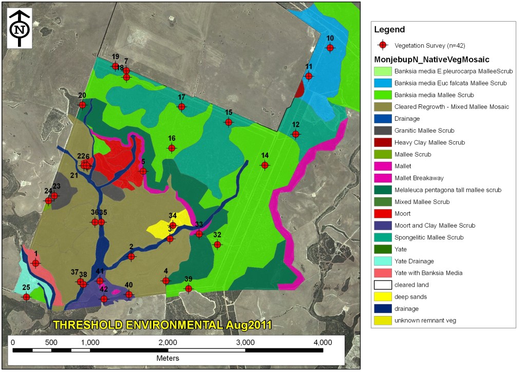
Botanical surveys of remnant vegetation on and around project areas provide a first indication of the type of plant communities that would have existed at a given site prior to clearing. Information from botanical surveys are compared to soil data to inform restoration plans.


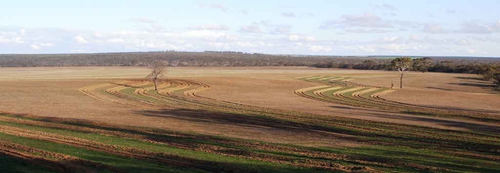
 LANDSCAPE TOPOGRAPHY AND SITE CONTOURS
Laser-level equipment with 10 cm accuracy are used to develop detailed contour maps for each project area. The data points are processed using GIS software to determine the specific surface contours and general layout of the local landscape to develop restoration planting designs, while ensuring erosion is minimised and water retention is maximised for each site.